Snow has dusted Mt Tarapōnui (at 1,308m Hawke’s Bay’s highest peak) as Florence and I strip to our swimsuits in a boatshed in a paddock just north of Te Pohue off the Napier-Taupō highway. It’s 10am on a weekday morning in November, and the air is bracing.
We’re at Mohaka Rafting (mohakarafting.co.nz) – an outdoor recreation operation set up in 2009 by local Norm Brown. With his stable of expert guides, he offers 3-5 day fully catered expeditions as well as an array of half and full-day river experiences, from a sedate grade 2 river ‘splash’, to a more adventurous grade 3 immersion (that’s us), to the white water, hardcore grade 5 quest. While most of his clients are tourists – international backpackers, cruise ship day-trippers – we’re on a mission to discover the joy and thrill of our own backyard.
We quickly layer up in a merino, fleece, wetsuit, windbreaker and the ‘booties’ that will keep our feet warm for the four-hour duration on the mighty Mohaka.
Together with a Danish farming couple, we’ll be rafting 25km of this 172km river on a journey that will take us through changing vegetation and breath-taking geological features, along wide-flowing, rippling courses, narrow limestone gorges, and frothing white water; a journey that will do more than convince us how dynamic and beautiful our landscape is in this pocket of backcountry wilderness.
In a white van and trailer, we wind downstream of the Mohaka Bridge along Waitara Rd, past Glenfalls DOC camping grounds, stopping in a pine clearing near Everett’s to view the magnificent Oxbow ringed by steep mountain ranges and down below us striking rock formations known as the Organs.

Here you can see how tectonic activity along the Mohaka fault line (one of seven that criss-cross the river) has created a distinctive geological boundary, between greywacke to the west and the younger, sedimentary rocks (sand-, mud- and limestone) of the East Coast basin. The Mohaka here runs along the base of the Maungaharuru ranges (escarpments formed by tectonic faulting and folding pressures; the hills below them by slumping and erosion), before cutting through at Maungataniwha, flowing out into the Pacific Ocean at Mohaka settlement between Tangoio and Wairoa.
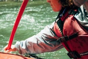
From Everett’s we take a dirt track down to the river, don life vests and hardhats before gently launching our raft. We begin on a smooth wide stretch: willows and pine plantations on the east bank, mānuka scrub and regenerating bush on the west, greywacke river stones – so far, so Hawke’s Bay.
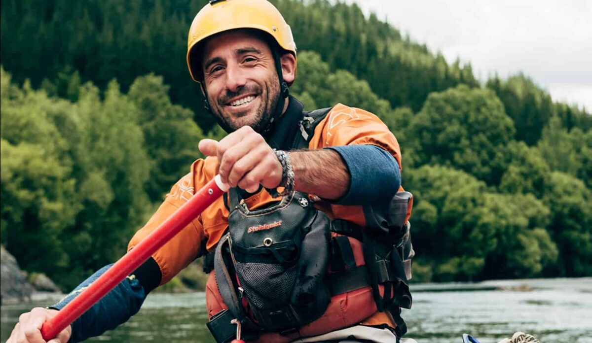
Our Italian rafting guide, Lucio (who works in the NZ off-season on rivers in Chile, Patagonia, Italy) talks us through the moves we’ll need to know and how to save ourselves if we tip; we practise – ‘easy forward’; ‘back paddle’, ‘stop’, ‘right over’, down!’ We quickly get the swing of things.
The river is wild and gorgeous, but along these middle reaches its green waters have a soapy silkiness to them that feels luxuriant. With ample opportunities to bob, plunge and drift, we take them all.

Mohaka translates as “place of dancing”, an ancestral name from Hawaikki. Indeed, as we cut and shimmy with our paddles, rafting the rapids becomes like a dance, in time to the water’s push and flow and Lucio’s adeptly attuned commands. Lucio says the Mohaka is world-renowned – when he tells people overseas he works on the “river of floating stones” (i.e. the pumice strewn here from two ancient volcanic eruptions), they know immediately which river he’s referring to.
Less than an hour in, we come ashore to explore an historic gold mine from the 1880s. No gold was found, so the two Aussie miners, we’re told, blasted it with gold dust and sold it on to some poor gullible bugger. It’s now home to an endearing weta whānau, which we meet in the narrow damp tunnel, eye to eye.
Florence is on the look-out for our blue endangered duck, but, endemic to this area, today it eludes us. We see plenty of common and paradise ducks. We pass a kiwi conservation area. And while there are intermittent birdcalls as we enter deeper into native beech forest on either side, we don’t hear the resounding sound of prolific birdlife the Maungaharuru was once famed and named for.
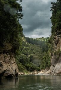
We navigate three sets of larger rapids before lunch, nothing scary, but exhilarating enough to make us whoop as the water splashes over us. The bush is denser now, the hills dramatic, steep. We come to the Upper Narrows – where the river runs deep and deceptively calm, walled in by smooth sedimentary cliffs. We jump from a 5-metre ledge.
We pass volcanic ignimbrite rocks and water-sculpted boulders in magical shapes – a frog, the imprint of a fish. We spot the story of tectonic uplift cross-bedded with geometric precision in a sheer cliff face. We scan layers of perfect fossilised shells – in this moment of seemingly unspoiled nature so far from the coast, a strangely symbolic reminder of rising seas.
As we head around the dogleg bend towards Te Hoe Drop, the largest set of rapids on this trip, I can hardly look down at the water for the sublime, jaw-dropping sight of Kingma Peak – two immense limestone walls high along the skyline, imposing and majestic and somehow spooky like the ruins of an ancient castle. This is Lord of the Rings territory, Florence whispers. And then it’s time to man the paddles as we twist and toss between boulders in a flurry of white whipped water – I confess my heart leapt a little.
Further on, before the last of the narrows, we face the intriguing cone peak of Te Kooti’s Lookout (733m). I smell sheep and, as the river turns, am vindicated to spy them high on a hill, cleared between bush. We pass a huge slip on the forested west, so big it dammed the entire river nine years ago – these friable pumiceous soils won’t hold still. As the river eases into open land, long grass, before the Te Hoe River convergence there’s a sense of emerging blinking into light.
We arrive at a bridge (and the end of our journey) just minutes ahead of the rain clouds sweeping over the ranges. I am suddenly cold, teeth chatter, toes numb, as I peel off my wetgear, pull on my dry clothes, a pair of socks. I am grateful for the hot tea and Farmbake biscuits, for the makeshift tarp awning. And looking out at the river moving swiftly ever on to the sea, in the stillness of this place in the middle of nowhere, I could wish for nothing more.
On the road trip back, we bounce along gravel through private land – Poronui Station – and up along the ridge of Landcorp’s Waitere Station at the back of Tūtira – a 2,000 ha hill-country sheep and beef farm. It’s treeless up here, and these high green pastures seem to touch the sky’s vast grey canopy.
NB. The minimum age for this trip is 12, and while I would definitely consider taking both my boys (age 12, 14) and my gold-card parents, and never, for a minute, felt less than safe, you’d want to be sure those on board are confident swimmers. The grade 2 trips are a family-friendly 5+.

